Iowa LiDAR Mapping Project
This website is a free service provided by the GeoTREE Center at the University of Northern Iowa.
Web-based GeoTREE LiDAR Download Tool
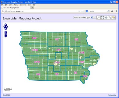
This tool allows you to download the Iowa LiDAR data in zip format. This is a new version of the LiDAR site. It can supports all the same features as the old version, but should be more responsive. Send us an email if there are problems.
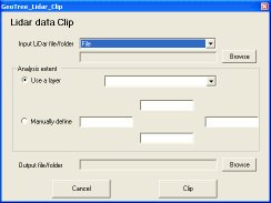
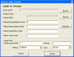
GeoTREE’s LiDAR Tool
It is an extension for ArcGIS software and allows you take the raw lidar data and produce several products such as slope, aspect, hill shade, etc.
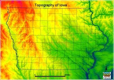
For more information related to state-wide project, please go to Iowa LiDAR page managed by Iowa DNR.